About Mapping the Underworld
Mapping the Underworld (MTU) is an ambitious 10-year research programme largely funded by the EPSRC.
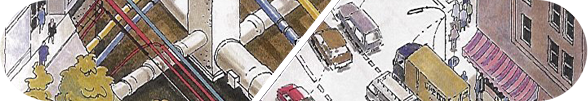
The problems associated with inaccurate location of buried pipes and cables are serious and are rapidly worsening due to increasing traffic congestion in major urban areas.
Mapping the Underworld started in 2005 with four complimentary research projects covering the feasibility of a multi-sensor location tool; mapping and position; data integration to yield a single repository for records; and RFID tags to assist future pipe location. The current project builds on this research by seeking to develop a multi-sensor device using ground penetrating radar (GPR), acoustics and electromagnetic technologies to locate all infrastructure in all ground conditions without the need for probing excavations.
It is a multi-disciplinary and multi-university research project bringing together experienced researchers with a range of different expertise. The project builds directly on the findings of the MTU Phase 1 feasibility study, which concluded that only the combination of the different technologies will allow for reliable detection of the buried assets and has the potential to be used for condition assessment. The new project started in November 2008.
The project aims to create a prototype multi-sensor device, and undertake fundamental enabling research, for the location of underground utilities by combining novel ground penetrating radar, acoustics and low frequency active and passive electromagnetic field (termed quasi-static field) approaches.
Methods
The multi-sensor device is to employ simultaneously surface-down and in-pipe capabilities in an attempt to achieve the heretofore impossible aim of detecting every utility without local proving excavations.
The combination of technologies, together with intelligent data fusion that optimises the combined output, in a multi-sensor device is entirely novel and aims to achieve a 100% location success rate without disturbing the ground, a task considered internationally to be the 'holy grail'.
The above technologies are augmented by detailed research into models of signal transmission and attenuation in soils to enable the technologies to be intelligently attuned to different ground conditions, thereby producing a step-change improvement in the results.
Results
Findings will be combined with existing shallow surface soil and made ground 3D maps via collaboration with the British Geological Society (BGS) to prove the concept of creating UK-wide geophysical property maps for the different technologies. This would allow the users of the device to make educated choices of the most suitable operating parameters for the specific ground conditions in any location, as well as providing essential parameters for interpretation of the resulting data and removing uncertainties inherent in the locating accuracy of such technologies. Finally, we will also explore knowledge-guided interpretation, using information obtained from integrated utility databases being generated in the DTI(BERR)-funded project VISTA.
Web Design by Darren Langley
