Main Area
Mapping the Underworld Final Dissemination Seminar
Posted on January 17th, 2013
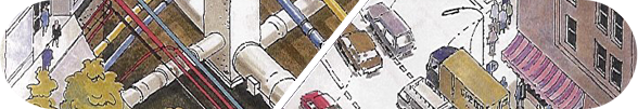
A one-day seminar and exhibition was hosted by the Mapping the Underworld (MTU) Team at the Ordnance Survey Centre, Southampton, on 12th December 2012 to showcase its research into the creation of a multi-sensor device to detect and map buried utilities. The project’s findings were presented alongside national and international developments in the area. The day presented an opportunity to explore several initiatives that seek to make streetworks safer, more effective and more sustainable.

The event covered UK, European and American perspectives of the challenges and latest advances in remote technologies for pipeline and cable detection, location and mapping. This appealed to a wide range of stakeholders who have to deal with buried utilities, from those who commission and carry out streetworks, and those who seek to maintain standards and regulations for such works, to those researching and developing cutting edge geophysical and mapping technologies.
The event proved a great success, attracting more than 120 delegates. Sitting alongside speaker presentations was an encouragingly extensive and busy exhibition, with exhibits on new market products and services from companies such as OXEMS (which has commercialised remotely detectable asset RFID tags deriving from research in the first phase of MTU’s research programme), Cardno TBE, JK Guest and the MTU Centre of Excellence.

The MTU Centre of Excellence is a commercially-driven training, standards and accreditation initiative set up in collaboration with MTU, notably being led by Dr Metje and Dr Royal. This training solution demonstrates how academic researcher can successfully come together with practitioners to understand industry needs and develop a facility that has far-reaching implications for industry standards and safety. This is an exciting development for the industry, as it opens up for the first time the possibility of a national certification scheme – something the industry has wished to see for some time. Alongside this initiative, Dr Metje is representing the MTU Team on a committee that is seeking to develop a new British Standard for utility mapping. [For more information please visit www.construction-skills-academy.co.uk.]
The core dissemination aspects of the event were a series of presentations by the MTU Team. The first of these brought delegates up to date on advancements in its four sensor technologies – Vibro-Acoustics, Low Frequency Electromagnetic Fields, Passive Magnetic Fields, and Ground Penetrating Radar. The presentations focused on the results obtained during field trials using the MTU Mobile Laboratory, in which the technologies are co-located on a single cart. The final stage for the project is to enhance and refine the sensor data fusion and data integration (with utility records and databases of the ground properties) to allow greater clarity and accuracy of utility detection and location.
So, where next? MTU’s Principal Investigator, Professor Chris Rogers, would like to look at non-invasive pipeline condition assessment technologies (Assessing the Underworld) and is awaiting reviews of a currently submitted research proposal to take this forward. Further information can be found at www.mappingtheunderworld.ac.uk
Another highlight was a presentation by Jim Anspach (Chair, ASCE Utility Committee and ASCE Codes & Standards Committee) entitled ‘America’s MTU – Advances from the USA SHRP Program’. In his presentation Jim reinforced the message that a UK standard is important to the future of the industry, not just nationally but internationally, but equally that this is not the first time such a standard has been attempted and its success is by no means ensured. Jim also highlighted how far the US has travelled down the road of research into finding buried utilities using non-invasive means, the initiation of which he credited to the close relationships formed with the MTU Team.
Dr Mike Farrimond (Past President, European Water Platform and Ex-Director, UK Water Industry Research) gave a presentation on the European Perspective. He outlined the progress being made across the EU and how the MTU project was at the forefront of these developments.

Professor Tony Rachwal (Surrey University and Ex-Director of Research, Thames Water) gave a presentation entitled ‘A Body Scanner for the Street – The Fit to UK’s Water Needs’. This term was first coined by Tony at the “Street Wise” workshop in 1996, and came from the industry need to know what was in the ground, where, in what condition and managed by whom! Tony summarised his presentation by saying that we have devoted vast amounts of time and effort to research so that we can assess the condition (diagnose illness) and prevent failures in the body, and indeed it is relatively easy to work on as we know where most of the “pipes” should be. However if we want a healthy body of networked infrastructure under our streets, that is somewhat more difficult; first we need to understand what the buried networks look like and then we need to determine the health of the pipes and cables, and the medium that supports them (the ground). All this requires a particular vision. MTU is providing this vision, and the body scanner in the street is taking shape in the form of the multi-sensor MTU device; however the Underworld Patient needs much more attention before we can be sure that it will develop a healthy life cycle.
Concluding remarks were delivered by Chris Rogers. The day had demonstrated that there is a clear desire from the MTU team, but also from industry, for the MTU project to succeed. It sits within a suite of complementary initiatives, the benefits of which, to industry and the environment, are potentially extraordinary. With time we hope to see these cutting edge technologies delivering further tangible results in the murky underworld of site surveying, buried utility health monitoring and far more sustainable streetworks.
A zip file of the presentations delivered at this event is available by clicking here.
Mapping the Underworld and BBC Radio 4
Posted on July 6th, 2012
Four million holes are dug every year in the UK. Five billion pounds are lost through the economic effects of disruption and traffic hold ups, while hitting a utility pipe or cable can prove fatal for those working on the road. Adam Hart- Davis reports about Mapping the Underworld on Radio 4 a major research project which is trying to solve the problems.
He takes us underground from his ancient ice house at the bottom of his Devon garden to report on Mapping the Underworld, the £3.5m programme involving universities throughout Britain. The aim is to improve how we locate the increasingly confusing and complex array of pipes, cables and sewers beneath our streets, and assess their condition – as well as ultimately providing a better map of what is beneath our cities to improve planning both above and below ground.
At the moment it’s often difficult to know where such utilities are – an estimated one in four of all holes are dug in the wrong place. Maps may not be accurate because original records of where the pipes and cables are located often use reference points on the surface which have long since gone.
Existing sensors may have problems finding what is underground because of soil or weather conditions, while modern materials such as plastic or fibre optics pose a challenge to existing technologies.
Adam Hart-Davis tries out the prototype of a multi-sensor cart where four different sensors operate together to produce an all-in-one solution, so if one technology doesn’t work well in certain conditions and with particular materials, another one will.
It is not an easy undertaking for the research teams or, as it turns out, for Adam testing and playing the multi-sensor cart.
-

- Adam Hart-Davis and the Mapping the Underworld Team
-

- Adam Hart-Davis interviews Prof Chris Rogers
Mapping the Underworld on Radio 4
Posted on March 20th, 2012
Mapping the Underworld is the subject of a Radio 4 programme titled Mapping Britain’s Underworld – Friday May 25, 11am.
The Mapping the Underworld research team hosted Adam Hart-Davis for a recent test day to demonstrate MTU technologies and cart development. The day forms part of a programme dedicated to the research being conducted by the MTU team.
The programme will be aired on Friday, 25 May 2012 at 11.00am on BBC Radio 4 and will be available for one week after the broadcast via the BBC iPlayer (its listen on demand facility – http://www.bbc.co.uk).
MTU animated video
Posted on October 18th, 2011
Pathways to impact video and podcast
Posted on October 17th, 2011
In March 2011 the Mapping the Underworld team hosted an awareness raising workshop to scope how the dissemination of the research carried out by the Mapping the Underworld programme could be further extended to not only the practitioners responsible for locating and implementing the repair and replacement of underground assets but also MPs, highway and traffic management officers and councillors involved in local government to represent the views of their councils, residents and businesses.
Click here to listen to a podcast interview with Dr Nicole Metje, who led this initiative.
The workshop discussions highlighted a number of differing perceptions and expectations of current practice:
- The lack of a common source of accurate data was a frustration expressed several times, as was the perception that poor communication and information sharing remained a problem; although this is beginning to be addressed.
- Across the country different approaches are taken by local authorities. Kent County Council and some London authorities use a permit scheme to coordinate streetworks. Such a scheme currently requires Department for Transport permission.
- The indirect costs of streetworks disruption, particularly when problems arise as a result of inaccurate location need to be taken into account. Repeated, uncoordinated works were a particular frustration for council officer and councillors.
- The owners of the assets need to be involved alongside the contractors, professional networks and local authorities in finding the right solutions to the problems.
- Communication is essential between all parties with an interest along with an understanding of the impact that excessive excavations can have on the industry, other businesses, commuters and local authorities when underground assets cannot be accurately located.
- Coordination and collaboration can be inconsistent and needs to be improved.
- Both the direct and the indirect costs of excavations are of importance when considering the impact of streetworks on the UK economy and the benefits of any potential solutions.
- There are significant issues, challenges and costs arise as the result of different and variable approaches to the location and excavation of buried assets.
- The inability to gather and share data and other information is a major concern.
- Information should be easily and readily available to residents and local businesses on the extent of the works planned.
- There were differing views on whether further regulation is required.
A New Era In Location, Protection & Safety
Posted on September 1st, 2011
Three landmark events will deliver the latest knowledge in both indoor presentations and outdoor demonstrations, of the latest utility location and protection systems, coupled with the imminent developments in utility professional training, qualifications and safety.
JK Guest, Kier and Mapping the Underworld – Utility Location & Protection
To register please visit:
http://emarketing.bluecoffee.com/jkguest/utility_location_protection_reservations_PIG/index.html
For information on sponsorship opportunities please contact Jon Guest on 01257 425742 or jon.guest@jkguest.co.uk
Northern Event:
Fri, 2 Sep, 2011 10:00 – 16:00
McDonald Hotel, Kilhey Court, Chorley Road, Standish, near Wigan, WN1 2XN
Midlands Event:
Mon, 5 Sep, 2011 10:00 – 16:00
JCB World Headquarters, Rocester, Staffordshire, ST14 5JP
Southern Event:
Tue, 6 Sep, 2011 10:00 – 16:00
Baden-Powell House Conference Centre, 65-67 Queens Gate, London, SW7 5JS (Map)
MTU/PIG Event 8 Sept 2011 – Pipeline Location and Condition Assessment
Posted on September 1st, 2011
Over £1.5 billion is spent annually on streetworks, and over 4 million holes are dug each year in and around our carriageways. It has been estimated that the social costs of such work in terms of disruption and delays adds a further £5.5 billion. Mapping the underworld is a major research programme aimed at developing a robust suite of techniques for identifying the range of services that underlie our streets. More accurate identification of this, often complex, network of pipes and cables has the potential to significantly reduce costs, delays and accidents. In this note, Mark Hamilton of Birmingham University and , Project Manager for Mapping the Underworld, provides a summary of an event involving some of the programme participants.
This year’s Mapping the Underworld (MTU) annual event was held at the Ordinance Survey, Southampton on the 8th of September and was supported by the Pipeline Industries Guild (PIG) and UK Water Industries Research (UKWIR).
The event attracted a hundred delegates including representatives from utility companies, those involved in delivering utility detection services, regulators, academia; indeed, anyone with an interest in locating buried infrastructure. Sitting alongside speaker presentations were select exhibits from companies such as OXEMS and JK Guest, who used the event to launch new to market products and services.
In the case of OXEMS, a commercial spin-out from the first phase of the Mapping the Underworld project, impact was clearly demonstrated through the launch of a new and cost-effective “underground cat’s eye” – the first ever designed-for-purpose, fully integrated underground asset management solution. This solution demonstrates how research can successfully come together with practitioners to understand industry needs and develop a product for use in the field. For more information please visit www.oxems.com
JK Guest, an industry leader in civil engineering and construction contractors, used this event as one of a series of three to announce that ground has been broken on the development of a new, national test site for utility detection. This is an exciting development for the industry, as accompanying it is the development of a national certification scheme – something the industry has wished to see for some time. See www.jkguest.co.uk
The main part of the event was a series of presentations. The first of these brought delegates up to date on the research of the Mapping the Underworld project and its four sensor technologies (vibro-acoustics, low frequency electromagnetic fields, passive magnetic field technologies and ground penetrating radar). The presentations focused on testing and the promising success of those results. The next stage for the project is full integration of the sensors onto one cart with accompanying data fusion and data integration to allow clearer and more concise interpretation of test results and to maximise the accuracy and interpretation of the information obtained. So what does the future hold for the Mapping the Underworld project? Its Principal Investigator, Professor Chris Rogers of the University of Birmingham, would like to look at non-invasive pipeline condition assessment technologies and is currently developing a research proposal to take this forward. Further information can be found at www.mappingtheunderworld.ac.uk
One highlight of the event was the presentation from Jon Guest of JK Guest who has been working closely with the MTU team, in particular Dr Alexander Royal and Dr Nicole Metje, to develop an accredited national testing arena for industry personnel. It is hoped that with continued pressure from industry members and Government lobbying new rules, strict monitoring and an accreditation system will be developed and introduced in the foreseeable future. Nicole, who is the UK member of the CI/ASCE 38-02 Committee (the American standard), has also been working with James Lewis of Cardno TBE towards the establishment of a UK standard. Their presentation scoped the path forward and the subsequent question and answer session reinforced the need for this work to continue. The benefits would include better regulated surveys by qualified and accredited surveyors employing safer working practices and, in the end, reduced excavation requirements.
Kevin Gooding of OXEMS described in greater detail their underground asset management solution. The OXEMS integrated solution, which identifies both PE and ferrous assets, is now available (initially for water utilities). It is a designed-for-purpose, integrated combination of: indestructible passive tags priced for network-wide use that are fixed directly to underground assets; robust, easy-to-use, state-of-the-science detectors for use in the field; and a comprehensive database that automatically updates with any intervention.
Another highlight was two presentations by Jo Parker of UK Water Industries Research (UKWIR) and Watershed Associates. UKWIR provides a framework for the procurement of research for the UK water industry and have been supporters of the MTU project since its inception. Together with the Pipeline Industries Guild, they were joint sponsors of this event. In her first presentation Jo reinforced the message that a UK standard is important to the future of the industry, but equally that this is not the first time such a standard has been attempted and its success is by no means ensured. In her second presentation Jo demonstrated the impact of Scottish trial of the VISTA project, which uses utility records and complementary techniques to build a GIS map of the below-ground infrastructure. The trial has been so successful that a full Scottish roll out is now underway. See www.ukwir.org and www.watershedassociates.co.uk.
Professor Kai Bongs presented on Gravity Gradient technology being developed at the University of Birmingham and how cold atoms and quantum physics can help to find underground voids and thus utility assets. This is a project in its infancy but if successful and integrated with other technologies, such as the four sensors developed by the MTU project, then this could have a significant impact upon how pipes and voids are located in the future.
Further presentations were given by the University of Birmingham on complementary research. This included the DART project – Detection of Archaeological Residues using remote sensing Techniques. The focus of this research is to find the best ways to employ different sensors (a multi-sensor approach) for the greatest heritage return (deploying techniques in a way that goes beyond replication and identifies complementary approaches). In particular, how do we improve the use of different sensors in regional/national prospection programmes and what are the best conditions (e.g. environmental, seasonal, weather, crop) for deployment? The University is also researching how to make buried water pipes smarter through the use of nano-sensors integrated into the pipes themselves.
Concluding remarks were delivered by Chris Rogers. The day had demonstrated that there is a clear desire from the MTU team, but also from industry, for the MTU project to succeed. It sits within a suite of complementary initiatives the benefits of which, to industry and the environment, are extraordinary. With time we hope to see these cutting edge technologies delivering further tangible results in the murky underworld of surveying and asset location.
For further information contact the Mapping the Underworld team:
Mark Hamilton, Project Manager, m.hamilton.3@bham.ac.uk, 0121 414 3544
www.mappingtheunderworld.ac.uk
February Event: Presentations
Posted on August 20th, 2010
The MTU Annual Event took place in February 2010 and was widely deemed to be a great success. We are in the process of producing an event report which will be posted as soon as possible. In the meantime, here are a collection of the day’s presentations.
Keynote Speech – Jim Anspach, Civil Engineering Consultant and Chairman of ASCE
Outlining technology, procedures and latest research in the USA.
MTU Lecture Session – Phil Atkins, University of Birmingham
Explaining MTU’s advances in sensor development and thinking; bringing the focus back to the problems we face in the UK.
ORFEUS Lecture Session – Guido Manacorda, IDS
Guido outlined the findings of the ORFEUS field trials and research programme, asking what these results may mean for the future.
Industry Viewpoint – Mike Shepherd of UKWIR
Mike outlined the beginnings and history of buried infrastructure which has led to the current streetworks situation we see today.
MTU Lecture Session – Dr Miles Redfern, University of Bath
Miles demonstrated how MTU plans to combine the sensors’ outputs, fusing this with intelligence data from records and ground condition information.
ORFEUS Lecture Session – Meinolf Rameil, TraktoTechnik
Meinolf addressed the future potential for reducing risk in no-dig utility installation with new drill head GPR tools and sensors.
The View of Ordnance Survey – Mike Darracott
Mike outlined how knowledge is being created from mapping data.
Website Additions
Posted on July 29th, 2010
Two Mapping the Underworld summary pamphlets have been added to our Publications page:
- The MTU Pamphlet, which provides an overview of the project and it’s background
- The Autumn 2009 Newsletter, which provides an update about ongoing research and site trials, along with a brief summary of the Project Launch, held in February 2009.
Our next newsletter will be published shortly, and will contain a detailed overview of the MTU-ORFEUS joint event, which was held at the Ordnance Survey in Southampton earlier this year.
Wheel Process Video
Posted on June 2nd, 2010
Dr Andrew Foo, a research fellow working on the Low Frequency Electromagnetic Fields Work Package, has produced a video for the blog:
Andrew says:
This video illustrates a wheel attached with a gray-coded panel. The video images, captured at a known frame-per-second rate, are thresholded to produce binary data, and then decoded to calculate the speed and movement of the wheel.
Pages
- Archives2 -
Categories
- Blog (10)
- News (11)
- Uncategorized (1)
Blogroll
Meta
